Part of any road trip are side trips, pullout photos, and maybe, even a map and a list of planned places to stay and eat. This is my wrap-up for our Valley of Fire photo trip and some of the photos I took on my return trip the following week. Up first, the images that I went back to get.
Windstone Arch. This is the one I really wanted.
Far wall of Windstone Arch. You get this by 'scooching' in slowly, careful not to damage any walls or floor, or camera or your head! No, just changing your lens will not work as you cannot see, for example the right side texture, from the back of the space. I was very mindful that these elements are fragile and too many careless photographers can ruin it for all of us.
I think this is the front view of Three Fins. Talk about dynamic range and shadows. This is an exposure blended image.
Fire Arch (from the western side). This is an afternoon shot to allow the sun to reach in and under the ceiling and eliminate an otherwise dark shadow or black cave look. You have to get close and low to create the clear opening for the sky. This is a small arch and I stayed away from the opening altogether.
Fire Arch from the front or south facing side. I had to laugh as I walked around. You would not see Fire Arch if you thought this was the place. You have to walk around, be amazed at the many faces, shadows, looks . . . changes in light can make such a difference as well. As I walked the short distance back to my car I was humbled by the sheer magic that was around me.
This rock formation is called 'The Piano". My mother wanted to know how big the bench was!! You can actually see this from the road. Like the Fire Arch, this rock formation only looks like a piano from one angle. This would probably be better as an early morning shot to open up the shadows underneath. Ah! So many morning shots and so few mornings! My lament (just kidding). This image requires that you move in real close to avoid a lot of scrub brush. I used a wide angle lens and crouched low to the ground to get a clear sky through the opening. Stand up and you get brown mountains in the background that sort of takes away the clean look of a plane.
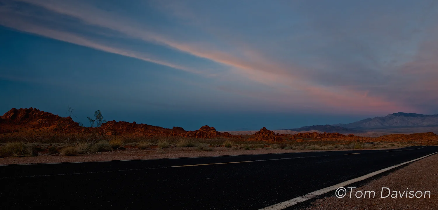
Below are some additional photos I took while moving from one specific site to another. Pretty amazing stuff.
Fudge anyone?
Our side trip was to the pedestrian bridge that overlooks Hoover Dam. Not a good place to be if you are afraid of heights or hate photographing electrical power lines!! Tom's computer blew up as he kept trying to use content aware fill in Photoshop to get rid of all those lines!! Just kidding, of course. The lines are as much a part of the dam scene as the dam and lake. You can do some research about Lake Mead . . . a pretty impressive landscape. A note here: Depending on the route you take from Hoover Dam up to Valley of Fire, you will pass through the Lake Mead Recreation Area. Unless you have some sort of pass such as America the Beautiful, you will need to pay $10, even if just passing through.
There is our mascot, Lefty. He gets around.
This shot and the one below give two very different perspectives of the same scene. My first thought was that this was a long shot. Yet, the metadata suggest otherwise. ISO 200 at 16mm, 0.67EV, f/11, 1/500 with Canon EOS 5D Mark III and Canon EF 16-35mm f/2.8L IS USM. Rick mentioned that he was intent on getting the shadow of the pedestrian bridge. With the proper settings he managed to get his composition, the detail that almost makes it seem longer than it is. Hmmm . . . a portrait orientation? By the way, a challenge here was to get the detail in the shadows and not clip the whites in the dam.
This image, to me, on the surface, is a wider shot than above. But, the metadata suggests otherwise. ISO 100 at 24mm, f/8, 1/250 with Nikon D600 and an AF-S Zoom Nikkor 24-70mm f/2.8G ED lens. The more I thought about it the more I am thinking one aimed straight and the other aimed a bit down. Then Tom pointed out that this is a stitched panorama!!! Two shots with the above metadata. I cannot see where it is stitched! (He is really good at this).
The metal power line suspension towers really are crooked!! They are angled and hang out over the water! Very weird looking as I expected one to crash into the canyon below just any time! Just appreciate the detail here. The clock on the rounded building, the brown cables held by the pulleys on the right side. These cables are readily seen as they cross the whole photo (see above).
OK, I have no idea where Barbara stood to take this photo. Part mountain goat? You can see the angled towers here as well.
One of the best parts about this particular trip was the many photo opportunities along the way. Tom took shots from the car, there were many pullouts, especially along Highway 166 in Nevada between Hoover Dam and the entrance to Valley of Fire.
Maybe the most photographed spot between Wickenburg and Kingman.
On the way to Valley of Fire we saw them putting these huge spurs in place.
The large dark rock mountain in the background is called the Rock of Gibraltar.
Tom took this from the car as I drove up a steep incline with "No Parking, Don't Even Think of It" signs and no pullouts for one of the best shots in the Park.
The rest of the images are taken along Highway 166 between the dam and Valley of Fire.
Lake Mead
We stayed at the North Shore Inn located on the main road in Overton, a peaceful little town with not even one traffic light. The Inn is owned by a couple and is not easily found when doing an internet search as it is not listed as some national chains. Its address is 520 North Moapa Valley Blvd. You can call 702-397-6000 for reservations. The rooms are spacious, clean and the hot free breakfasts are better than the average fare. They are accustomed to photographers from all over the world who come to shot at Valley of Fire. In fact we had breakfast listening to two other groups that were there. Prices are very reasonable. There is one other small hotel in Overton. I would not recommend it.
There is a McDonald's in town. We chose, instead to eat at Sugars, where the food is pretty dang good, very reasonably priced and we found that most every order would feed two people! There is an ice-cream restaurant that also serves sandwiches and breakfast, but I personally preferred Sugars. A Chinese restaurant about 5 miles from Overton was recommended and not bad for a break if you want one. One thing to think about ahead of time is lunch. We chose to take a break during the harsh light of midday and travel back to town for lunch.
I subscribe to a quarterly newsletter called Photograph America. Robert Hitchman travels extensively and puts the newsletters together to give photographers some great tips on the areas he has travelled. We used his newsletter on Valley of Fire to get the best shooting times and ideas for how to approach a particular rock formation. You can check out his website at www.photographamerica.com. You can buy individual newsletters for $8, go for the annual subscription for $25 or get the whole collection for a whole bunch more $$.
I have three (maybe more) rock formations that I want to photograph. So, I will be going back. Will probably be in the fall.
This wraps it up. I loved Valley of Fire and I hope that you have come to love it as well. If you go you will not be disappointed.