Onion Valley

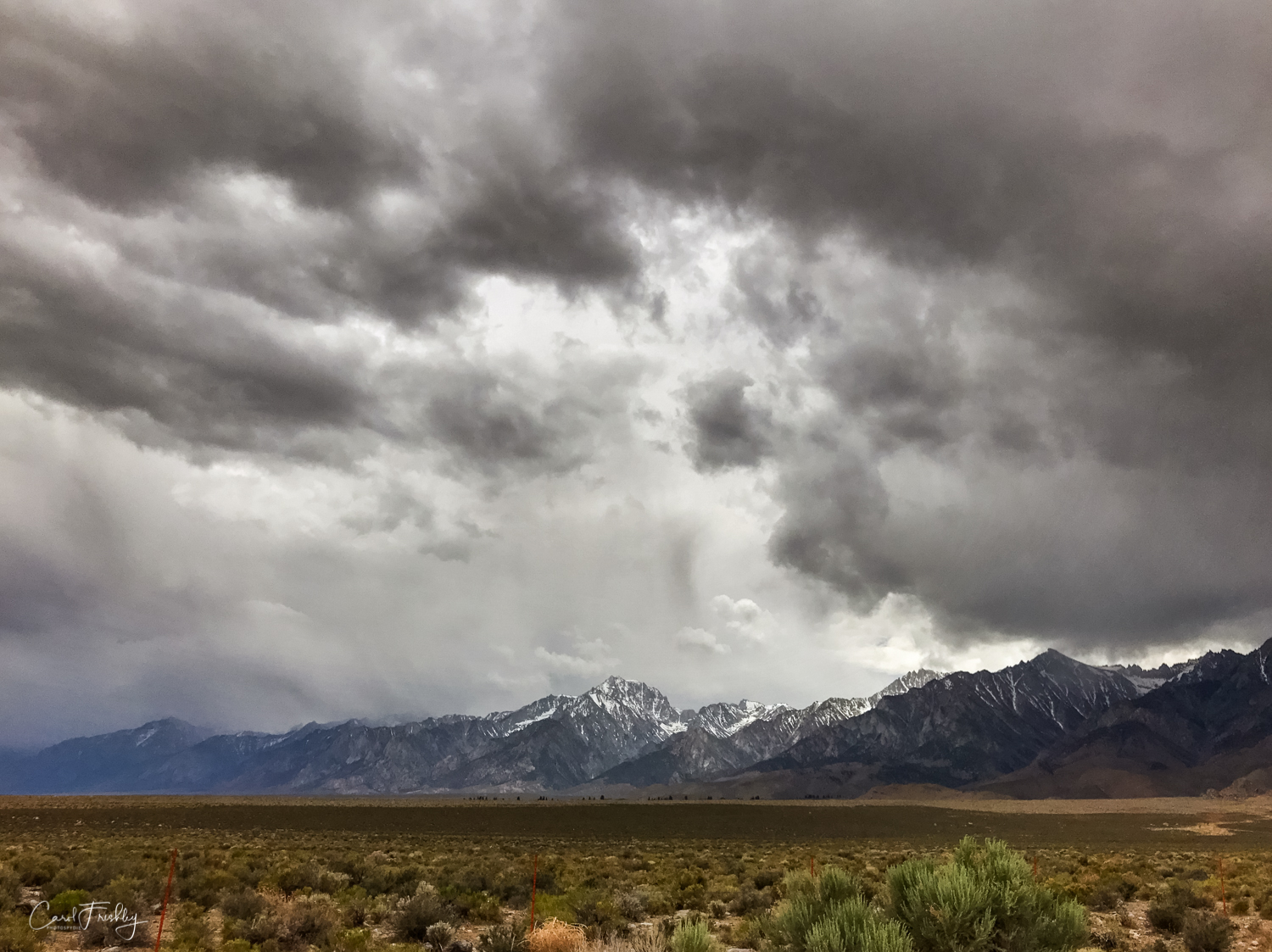
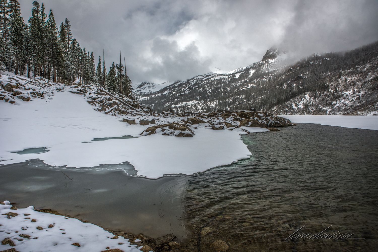
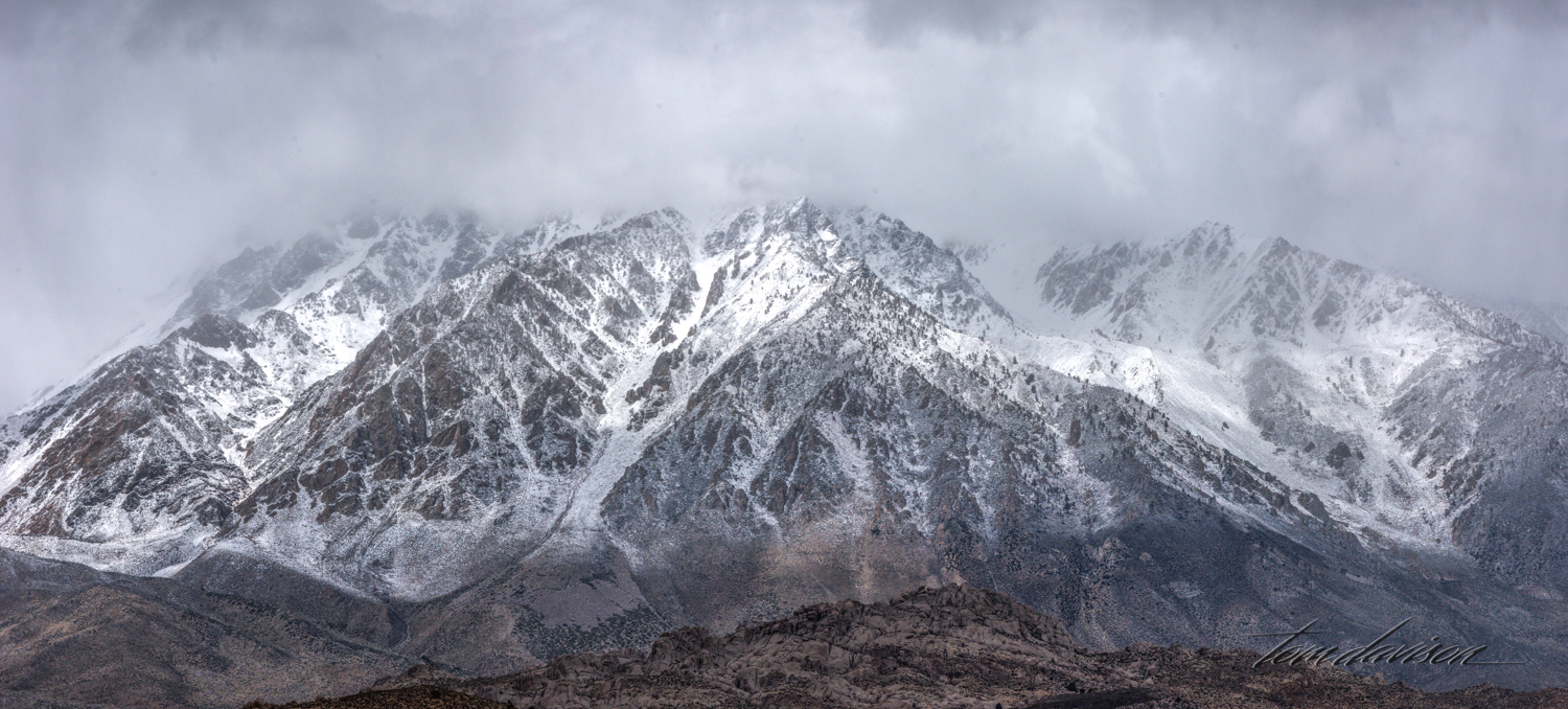
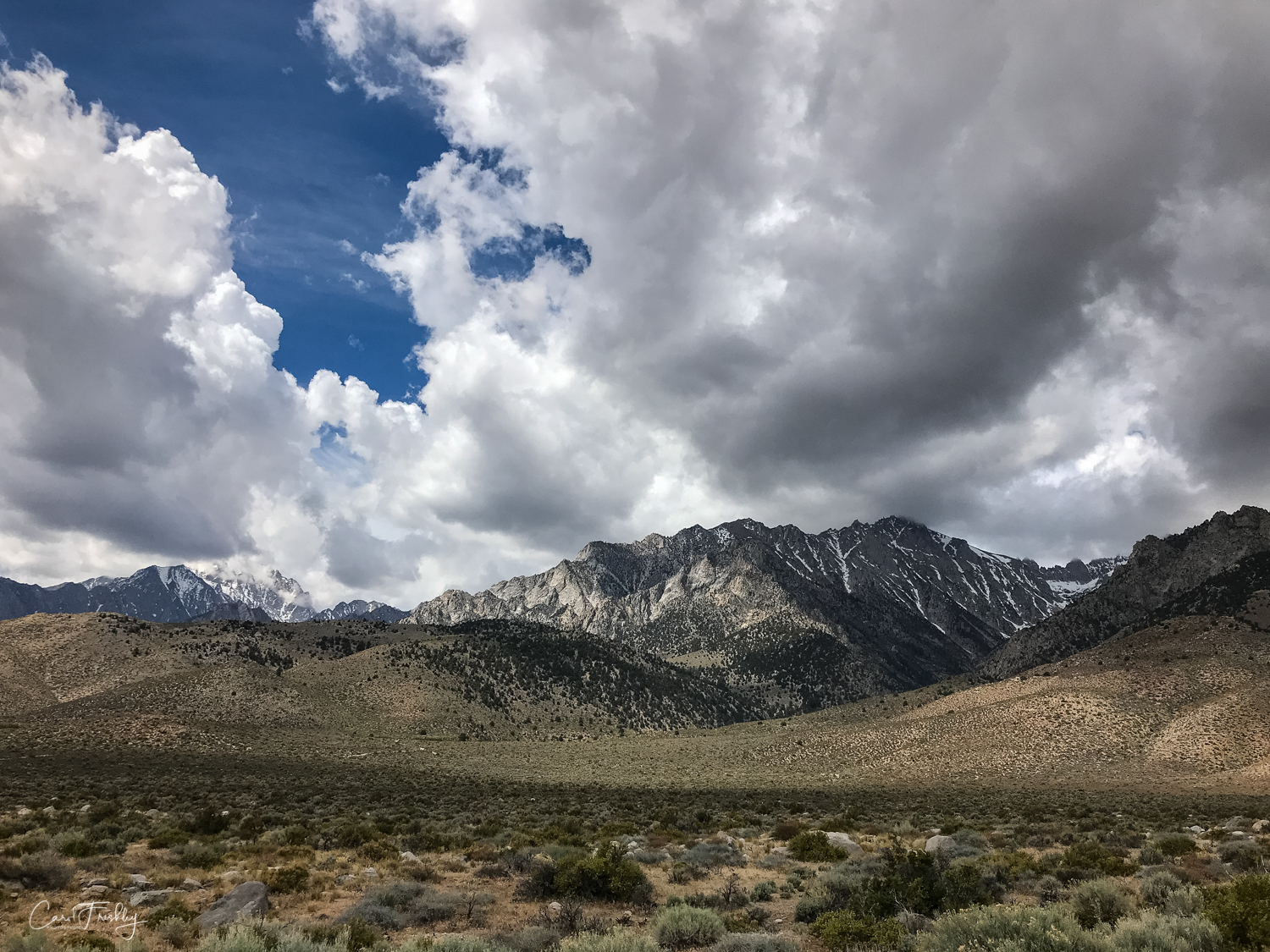
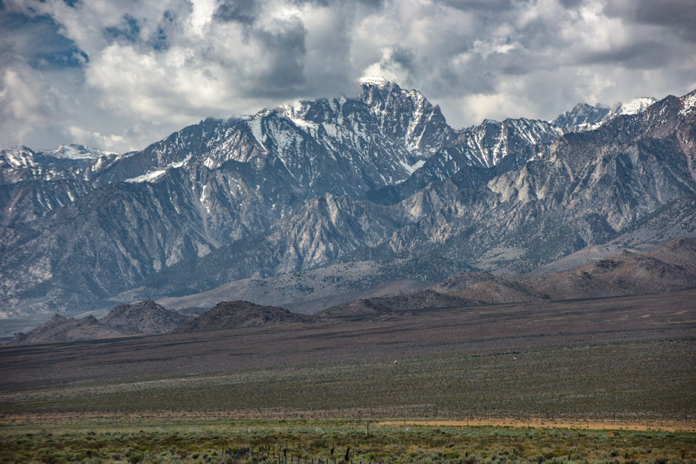
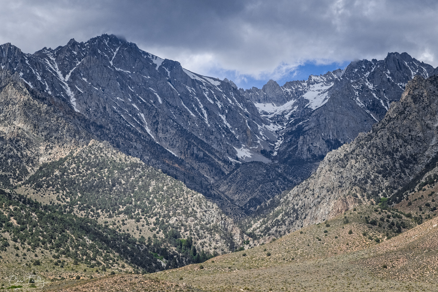
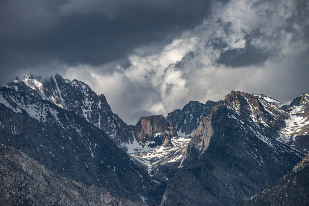
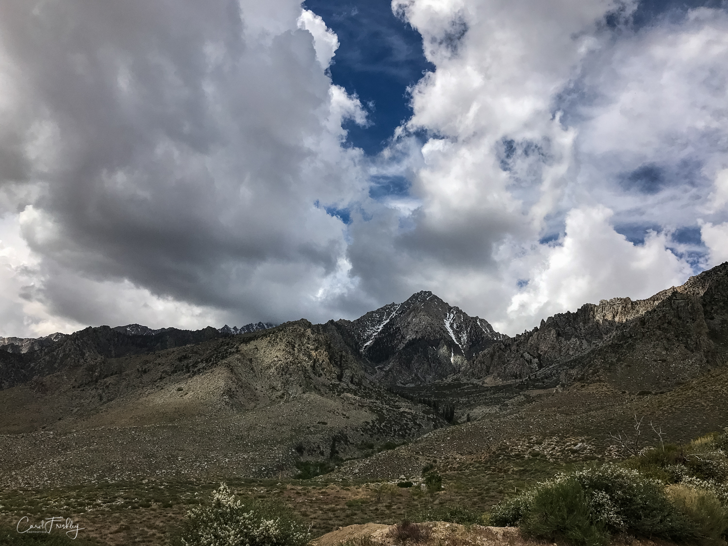
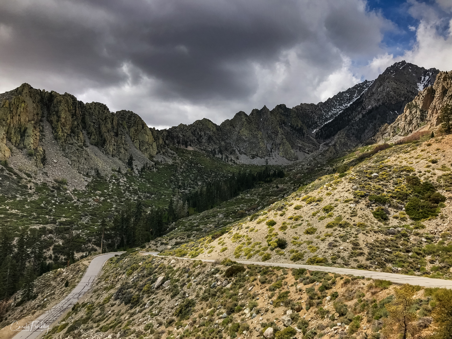
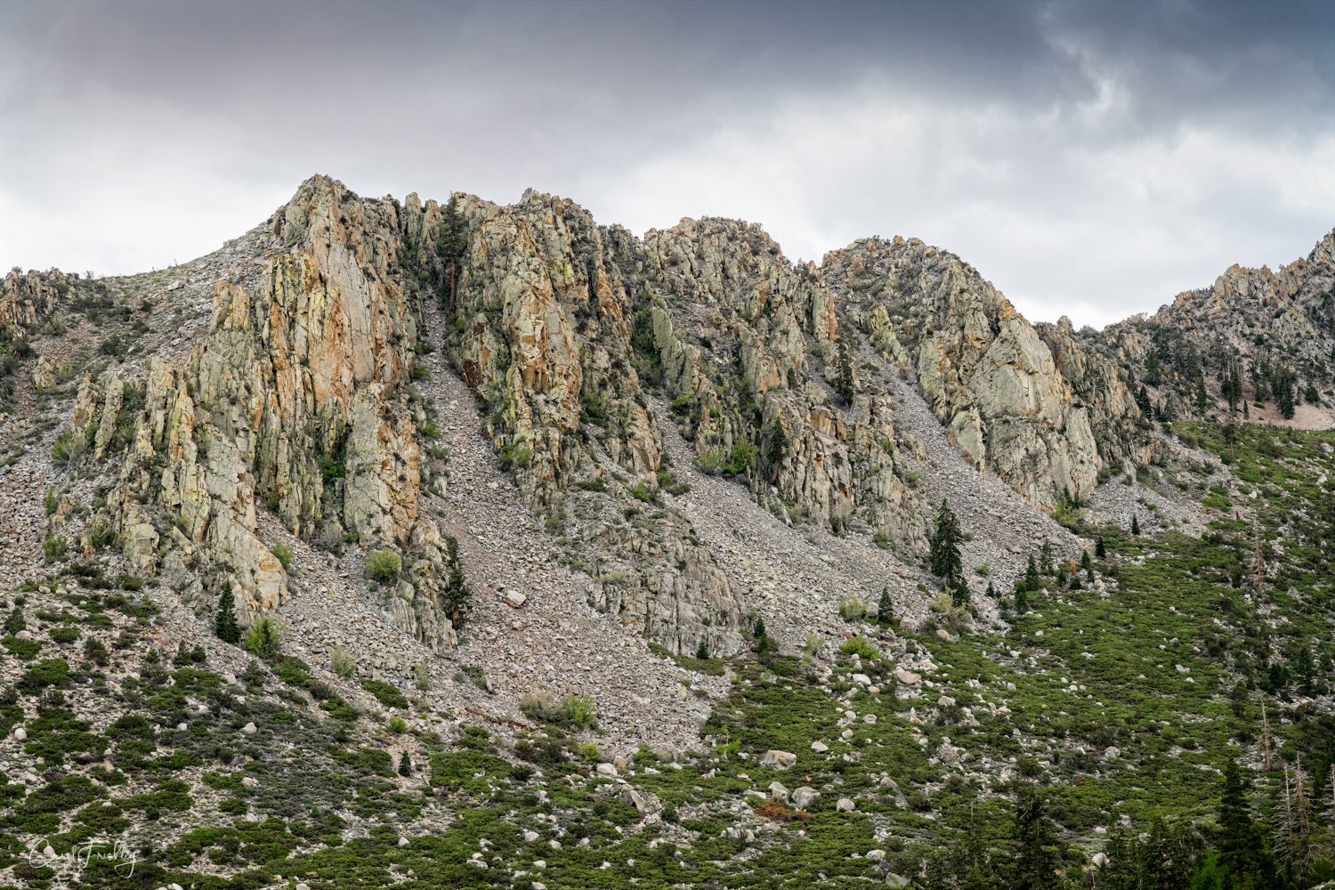
One starts up the canyon which for some reason is called Onion Valley.  But, it does not smell like onions and they are not grown in the area!  I am sure there is a story but I could not find it.  It is a popular recreational area that usually opens up about mid-May.  Trails from Onion Valley provide acces to the John Muir Wilderness and Kings Canyon National Park.  There is a campsite at the end of the trail that has 29 campsites for tent camping or RV type units less than 25 feet in length.  The road up the canyon is so narrow, winding, and steep that no one in their right mind would take anything longer up anyway!  We had a great drive up and down as the weather went from nice pretty white clouds to stormy dark clouds.  

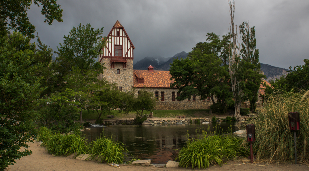
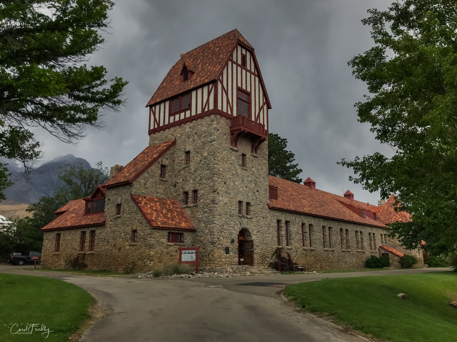
On the way home we stopped at the Mt. Whitney Fish Hatchery.  Founded in 1917, Mt. Whitney Fish Hatchery provided fresh trout to the Sierra Nevada region for nearly a century. After a series of natural disasters in 2008, the hatchery closed and the focus shifted to preservation and education. The hatchery portion is no longer operational but the building houses an interesting museum and is photographically interesting with its early 20th century archetcture.

Onion Valley-4.jpg
Onion Valley TD-1.jpg
Onion Valley-3.jpg
Onion Valley TD-3.jpg
Onion Valley TD-4.jpg
Onion Valley-1.jpg
Onion Valley TD-5.jpg
Onion Valley-6.jpg
Onion Valley TD-6.jpg
Onion Valley-7.jpg
Onion Valley TD-7.jpg
Onion Valley-8.jpg
Onion Valley TD-8.jpg
Onion Valley-9.jpg
Onion Valley TD-9.jpg
Onion Valley TD-10.jpg
Onion Valley-10.jpg
Onion Valley TD-11.jpg
Onion Valley-11.jpg
Onion Valley TD-12.jpg
Onion Valley-12.jpg
Onion Valley TD-13.jpg
Onion Valley-14.jpg
Onion Valley TD-14.jpg
Onion Valley-15.jpg
Onion Valley TD-15.jpg
Onion Valley-17.jpg
Onion Valley TD-16.jpg
Onion Valley TD-17.jpg
Onion Valley TD-18.jpg
Onion Valley TD-19.jpg
Onion Valley TD-20.jpg
Onion Valley TD-22.jpg
Yosemite Fish Hatchery-4.jpg
In times past, fingerling trout were transported by mule to small and big lakes all along the Sierra Nevada.

In times past, fingerling trout were transported by mule to small and big lakes all along the Sierra Nevada.

Onion Valley TD-23.jpg
Onion Valley-18.jpg
Onion Valley TD-24.jpg
Onion Valley-19.jpg

Sabrina and South Lakes Trip

Lake Sabrina is a lake created by damming the middle fork of Bishop Creek.  The dam was built in 1907-8 to supply a constant flow of water to to hydraulic power plants. It is a popular recreational area with a small cafe and dock but on the day we visited there were almost no people and a lot of snow.  The cafe was open but not for much more than a cup of hot chocolate.  The roads were plowed and clear so as we headed back down towards Bishop we decided to visit South Lake, a short side trip.  South Lake is 170 acres of 'fishing paradise' at over 9,700 feet in elevation.  No surprise that it was still covered in ice and snow!  Both lakes warrant a return trip later this month and again in the fall when we return to the area.

From the deck of the cafe at Lake Sabrina.  Wind was strong and the hot chocolate welcome.  We did not stay long or hike around.

From the deck of the cafe at Lake Sabrina.  Wind was strong and the hot chocolate welcome.  We did not stay long or hike around.

As we went up the mountain towards Lake Sabrina the snowfall was heavier.  Fortunately the snow plows were keeping it clear and we just took the road slowly, willing to turn around any time it got uncomfortable.

As we went up the mountain towards Lake Sabrina the snowfall was heavier.  Fortunately the snow plows were keeping it clear and we just took the road slowly, willing to turn around any time it got uncomfortable.

Lake Sabrina TD-4.jpg
We crossed Bishop Creek. a couple of times.  In several places it was really roaring.

We crossed Bishop Creek. a couple of times.  In several places it was really roaring.

Road to Lakes Sabrina and South-1.jpg
Lake Sabrina TD-2.jpg
Lake Sabrina TD-10.jpg
We drove through Aspen Glen, a nice little community with a great breakfast place that we tried out on the way back down and on our way to South Lake.

We drove through Aspen Glen, a nice little community with a great breakfast place that we tried out on the way back down and on our way to South Lake.

Lake Sabrina TD-1.jpg
Lake Sabrina TD-21.jpg
Lake Sabrina TD-22.jpg
Folks in Alpen Glen have plans for the future!

Folks in Alpen Glen have plans for the future!

One large pond made for some interesting photography.

One large pond made for some interesting photography.

Road to Lakes Sabrina and South-14.jpg
Lake Sabrina TD-13.jpg
Fishermen at South Lake.  Dedicated souls!!

Fishermen at South Lake.  Dedicated souls!!

Lake Sabrina TD-14.jpg
This is really South Lake, even though it looks like White Lake!

This is really South Lake, even though it looks like White Lake!

South Lake covered in ice and snow.  Very cold.

South Lake covered in ice and snow.  Very cold.

Lake Sabrina TD-16.jpg
South Lake from the parking lot above the lake.

South Lake from the parking lot above the lake.

Lake Sabrina TD-18.jpg
Lake Sabrina TD-12.jpg
Road to Lakes Sabrina and South-12.jpg
Road to Lakes Sabrina and South-11.jpg
Road to Lakes Sabrina and South-15.jpg
Road to Lakes Sabrina and South-18.jpg
Road to Lakes Sabrina and South-25.jpg
Waterfall spotted on our way home.

Waterfall spotted on our way home.

Lake Sabrina TD-28.jpg
Almost home!!  Wonderful day of experiencing Mother Nature in play.

Almost home!!  Wonderful day of experiencing Mother Nature in play.

Sedona With Snow

We watched the weather for weeks hoping to get the 'perfect' day to drive north and get some winter snow photography.  I love the red rocks of Sedona covered with snow so that location was my first choice.  Finally, it seemed like that perfect day had arrived.  Six photographers, pretty nice weather and lots of shared company make a very nice photo adventure.  Kati was in Sedona the day before we drove up and has graciously contributed her photos showing the storm clouds building up and then snow falling.  Enjoy.

When we drive to Sedona we usually stop first at the Forest Service Information Center.  Not only is the view pretty darn good, but it gives us an opportunity to check out road conditions with the staff and makes sure all our favorite sites are open.

Finally, we decided it was time to drive into Sedona.  Of course, we had to stop along the way or take photographs from a moving car.  To me this looks like another praying monk.

Taken the day before our trip.

We wanted to photograph the valley from the the nice overlook across from the airport parking lot.  But, they now charge $3 just to park!!  We decided to head a bit down the mountain and take our photographs from the trail head of a path that goes to the top of the hill.

I think Karen hiked to the top but I decided against what looked like a slippery slope.  We can only have one person at a time in a sling in our household!

OK, time to get back on the road and head to Red Rock Crossing.

With one very interesting stop along the way.  I think this is before the Crossing, but am not sure.

We get excited by puddles!

Rick has a new filter and filter holder (Lee, I believe) and I asked him to share how he had stacked them for some of the photographs he took.  This image was captured with both a circular polarizing filter and a 2 stop ND graduated filter.

On this image Rick used a circular polarizer and a 3 stop ND filter.

Rick used a circular polarizer and a 1 stop graduated ND filter.

After lunch Rick and Barbara made a side visit to photograph the Chapel on the Hill.  Most of the snow had already melted in Sedona by the time we left.