If you would like to take a day and spend it in awe behind your camera's viewfinder this would be the drive to take. It is a 66-mile route that holds a photographic opportunity at just about every curve you take. The route is part of the Deschutes National Forest. Tom and I were coming around more bends in the road than we can count with a "wow"! Plus, the wildflowers are in their peak blooming stage and the weather was perfect, although very windy. Locals are complaining about the wind this year. For us it meant choppy lake waters and tough-to-get photos of the wild flowers. The photos are more or less in the order they were taken so you can enjoy the trip as we took it. No promises, however, that every one is properly placed.
Mt. Bachelor from the meadow along the road leading to Todd Lake. Mt. Bachelor is a highly rated down-hill ski area with numerous ski runs on its north face and a summit of 9,065 feet. We opted not to drive further down the road to the lake, saving it for our next trip.
Same meadow as above. While Tom ventured out into the meadow I stayed with the car that was not properly parked (over the top parking issues at most stops). I spent the time in a futile effort to capture some water droplet photos in a nearby pine tree.
I would give this one a 10 on green and a 0 on reflections!
Our first clue as to why the sign several miles back told us that Sparks Lake was closed. We later found out that it will re-open on July 18th.
While we were bummed that Sparks Lake access was closed as that was the #1 spot we wanted to photograph. We made the best of it by photographing the meadows around the lake that are accessible along the road.
Looking backwards away from Mt. Bachelor we saw two artists plein-air painting. The snow-capped mountain behind her is South Sister.
If you are willing to walk across a boggy bottom you can find small creeks running either into or out of Sparks Lake. Good time to get your shoes wet!
A short drive around the curve from the last shooting location we came to the marker that commemorates Ray Atkinson, the one and only ever Oregon Photographer Laureate. He dedicated his life to photographing the Pacific Northwest and is credited with inspiring several generations to protect the area's beautiful wilderness.
As above.
A wider take on the scene.
Once again I find myself thrilled by such clear water. Those are shiny rocks at the bottom of this small stream.
Devil's Lake known for its green, aquamarine or turquoise color, depending on the light. It is popular with fishermen and kayakers.
From the banks of Devil's Lake.
This is Elk Lake. It is large and on the opposite bank there is a lodge, restaurant and boat rental business. There were several families with small children enjoying a picnic right on this sandy beach.
Look carefully and you can spot the Lodge across the lake. That would be our destination for lunch.
Elk Lake.
After an expensive lunch (location, location, location), we explored the marina. After seeing Tom's shots I deleted mine.
Elk Lodge Marina.
Tom comes up and asks me if I saw the reflections of the kayaks. No, of course not. He sees everything as an artist. I am not so gifted but working on it.
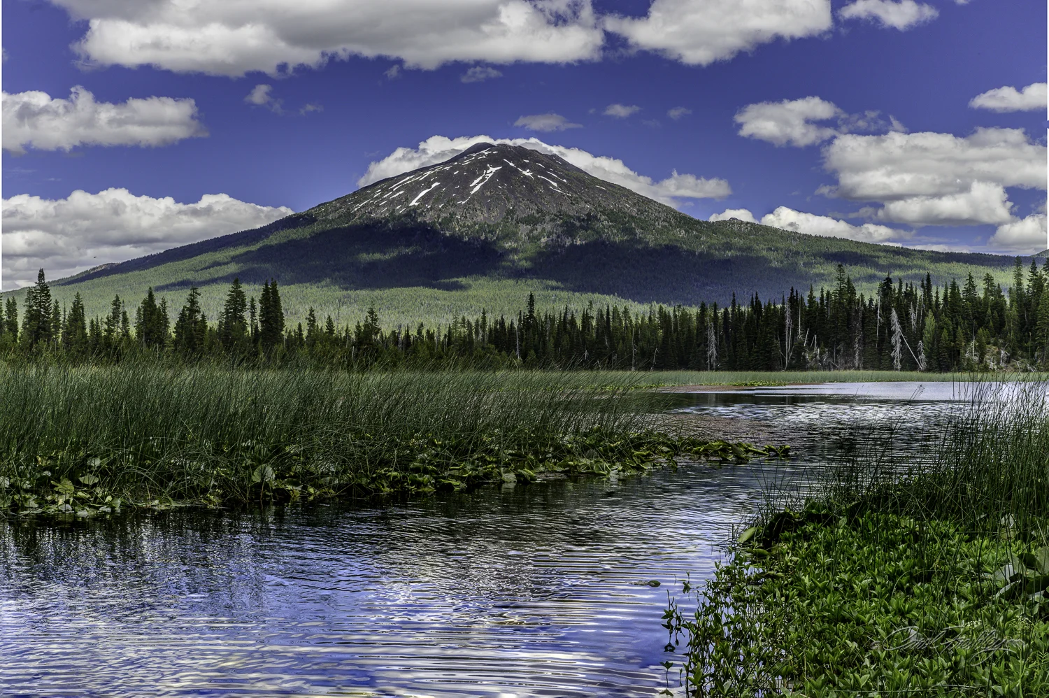
Down the road from Elk Lake, after passing several more lake opportunities, we parked (sort of) at Hosmer Lake. In is popular kayakers and canoers. An excited kayaker just returning told us tshe hat they had just completed a 5 mile trip to a gorgeous waterfall. We must go take pictures she told us. Well, not on this day, but maybe some day. This is the west side of Mt. Bachelor.
From the boat launch area at Hosmer Lake. These kayakers are lined up like planes coming into an airport.
Hosmer Lake away from the boat launch.
Hosmer Lake.
Just one more.
The first in a series of dams on the Deschutes River broadens the river to form a large plain called Crane Prairie Reservoir. It is reputed to be one of the best fishing lakes in Oregon. Osprey join humans in the pursuit of fish and there are enough of them nesting sites that an Osprey Observation Point has been created to allow birders to watch these fish hawks dive for their dinner.
Another take on the small marina.
Take a moment and sit with me. Please don't talk. Just listen.
I walked by the rocks and scared this little fledgling out of its hiding place. We could spot a parent with food in its beak flying back and forth waiting for us to leave. Tom said the parent eventually flew in and fed it.
Across the reeds you can see, left to right, South Sister, Broken Top and Mt Bachelor.
The campground was FULL. Many families were at the lake enjoying their summer vacation.
Next up are the photographs taken from the passenger side of our 'toad'. These photos, to me, are some of the best memories that could only be gotten by being willing to shoot from the car. There are few pull-outs along the road and often even they are only safe for one direction of traffic. Enjoy.
Mt. Bachelor
Broken Top.
Broken Top.
We drove on home, tired and happy. We hope to go back one more time before we leave the Central Oregon area.