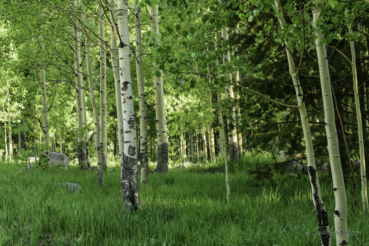
South Park City

As we drove into Fairplay we noticed what looked like a collection of old buildings and mining equipment.  It was South Park City (SPC) and a full afternoon of photography only scratched the surface of the history and lifestyle of Colorado's early mining days displayed at SPC.

There are 35 original buildings on the site.  In 1957, the South Park Historical Foundation was organized and the decision was made to put buildings and artifacts on the outskirts of Fairplay, one of the few surviving mining camps.

When I walked in my first reaction was, "Wow!  This could be a fun adventure.  There were interpretive signs everywhere.

The only item that is new here is the fire extinguisher.  Many mining towns were gutted by raging fires and so one of the considerations in restoring a mining camp was that it be placed in an area where it could be protected by fire and police services.

With the page opened to the hymn Holy, Holy, Holy.

Old and tattered.  Still a treasure.  The interpretive sign pointed out that the settlers used newspaper to insulate their walls.  That can be seen in many of the buildings.

You can still read the legal notices on this newspaper.

Tom and I think this is Rache's Place.  I did not go in this one.

There is a museum showing animals that used to be plentiful in the area.  Early Ute's used this area as their summer camp.  The valley is supplied with water from the North, Middle and South Forks of the South Platte River.  The lush vegetation provided for an abundance of game which drew trappers and hunters to the area even before gold was discovered and miners arrived.

There was a building that contained a good selection of dioramas (Tom loves them).  I tried taking a photo of one and it turned out horribly!  Enjoy his.

This is the saloon.  My guess is that the pink is a faded red.

Taxidermy must have been a thriving business.  It was seen in private homes, the bank . . . everywhere but the laundry!

In the bar.

A private side room where gambling could take place.

This is an old soda fountain machine.  You can still read the names of the different flavors.  The machine is quite exquisite.  It must have cost a fortune.

Families in the area were fully supportive of the development of SPC.  They searched their attics, basements, and barns for anything that would be an appropriate representation of the late 1800's in the area.  They came up with approximately 40,000 items!!!

As an herbalist I recognized many of these medicines:  Blue Flag, Calamus, and Cardamom.  Not sure how effective Dr. Miles Tonic was, however.
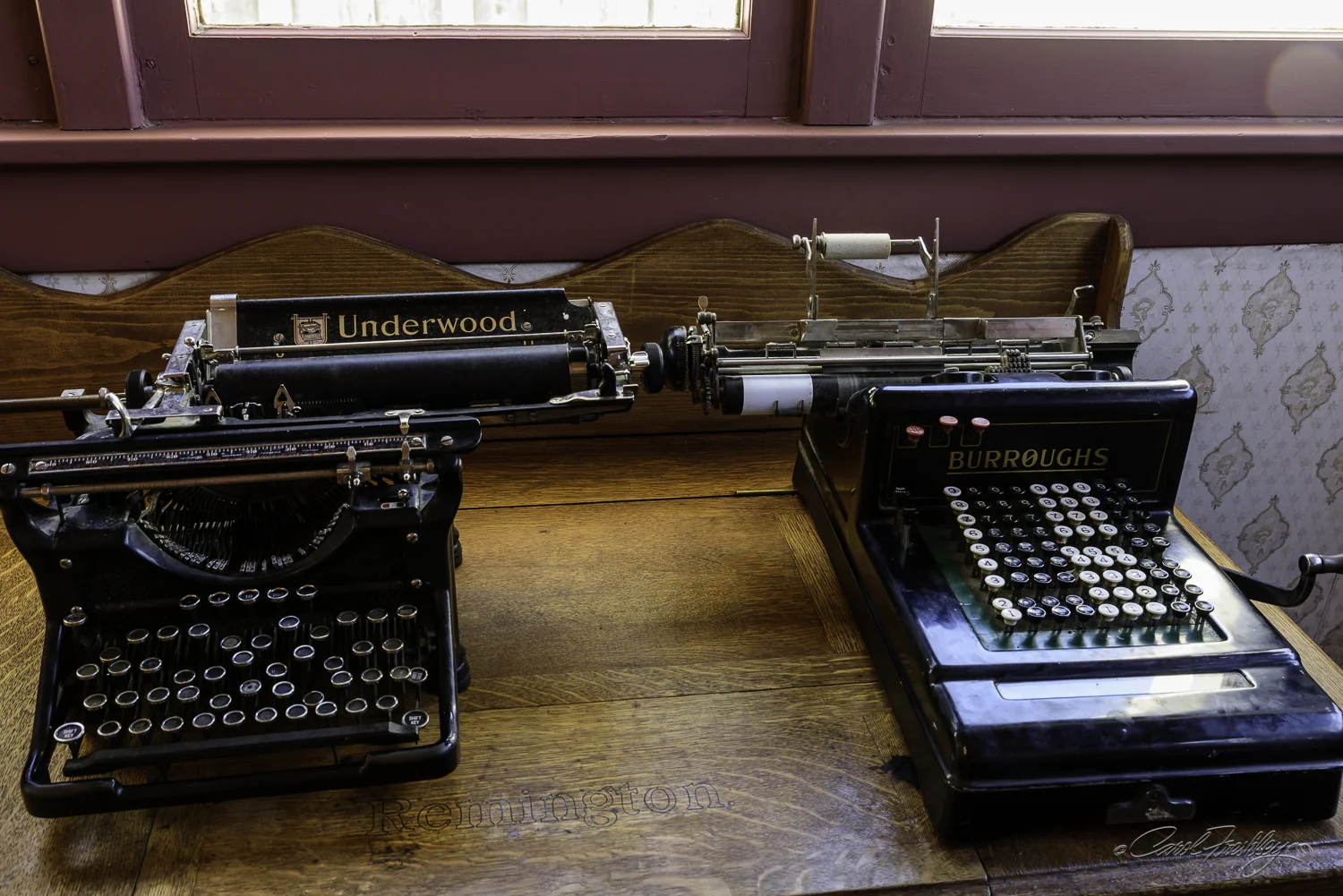
The machine on the left still has its keys stuck!

The machine on the left still has its keys stuck!

Bank's teller window.

General merchandise store.

I really worked hard at getting this photograph.  Most of the exhibits were enclosed with glass and sometimes the reflections from the windows made it really tough.  In case you are on a small screen, the sign says' "A Study in Cause . . . Effect.  Don't judge a corset by its face.  Look on the other side and insist on having the seams run around the body.  This is an exclusive feature of Thompson's Glove Fitting Corsets."  The other sign warns users NOT to use pins on their corsets as doing so will void the corset's warranty!

Tobacco on the bottom and mercerized thread on top.

On the second shelf there was a HUGE rat trap along with poisons that were guaranteed to get rid of the pesky rodents.  Top shelf had fishing supplies.

Doctor's office.  There was a diplay which I did not get o good photo of showing obstetrical 'tools'.  Nothing much has changed there!  They looked almost exactly the same as what is used today.

There was a restored Forest Ranger's cabin.  This was posted in the small office.

Back room or living quarters of the Forest Ranger's cabin.  A small table was just to the right.

Forest Ranger's office.  This was the only image that required exposure blending.  The top of the table was covered with a fine leather.

Yes, that is me in the mirror inside the shop.

Room with tons of carpentry tools, each one carefully labeled.

One room schoolhouse.  The rope was used to ring the school's bell and just about every kid visiting SPC would stand outside and ring it over and over and over.

I loved the comment on the blackboard.  I was not aware that God had his own 'rule' or that metric was a foreign scheme!

I thought the Stage Stop was one of the most interesting buildings.  Here, guests would stay overnight to continue on their journey the next day.

A large dining room would have fed the traveling guests and possibly the stage hands.  Luggage of the time is shown beneath the steps.  Upstairs there were two guest rooms.

In a corner of the Stage Stop.

In a corner of the Stage Stop.

A closer look at some well worn luggage.

This was the nicer of the two upstairs guest rooms.  She must have been a 'special' guest.

A barn for the stage horses.

These wooden pipes were used to carry water!

The arrastra was a primitive ore crusher designed to have a mule move a heavy rock around in a circle such as this on top of gravel to crush it for further processing.
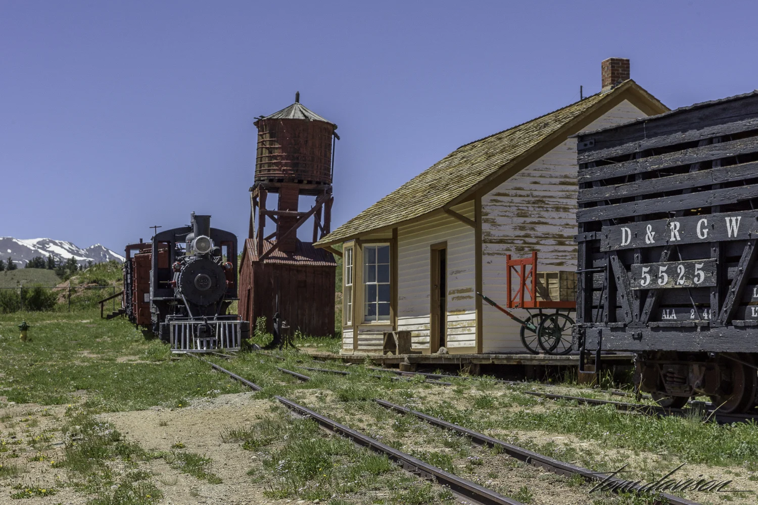
You can get up into the locomotive.  Kids loved it.

Assayers office.

A precursor of today's laundromat.  I was fascinated by the different kinds of irons.  Some were even heated with a small gasoline run heater.  Scary!
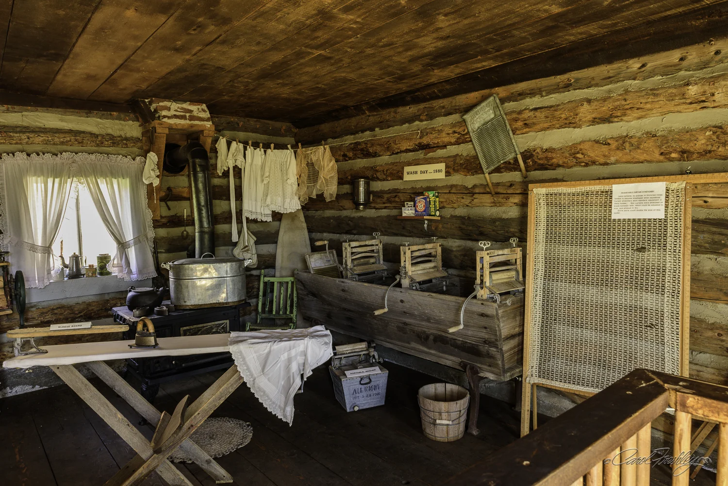
If you look along the right wall you see what I took as an attempt to create an assembly line for doing laundry.  Could have been useful for taking in miner's laundry.

If you look along the right wall you see what I took as an attempt to create an assembly line for doing laundry.  Could have been useful for taking in miner's laundry.

Found in the Homestead House..

Whew!  If you have made it to the end of this virtual tour of SPC . . . well congratulations!!

Maroon Bells

The image below is my personal favorite of the photos I took of Maroon Bells at sunrise.  I stopped shooting once the sunlight reached the tops of the trees and returned to the car to thaw out!

Maroon Bells-16.jpg

I simply could not imagine that Maroon Lake would be clear enough to reflect Maroon Bells at the optimum 'right at sunrise' time.  Plus, we read that you have to be there upwards of an hour before sunrise to get a good spot (the perfect spot) as it is a very popular photographic opportunity.  Every lake and river we had seen had been cloudy, muddy and windswept.  We decided to take a scouting trip a day before and check things out before committing to leaving Carbondale before 4 in the morning!  The images below are from that scouting trip.

But, first you have to get there and Tom takes his well earned position as photographer en route seriously.  This is Mt. Sopris.

Wow!  Arriving on the scene I was encouraged by the clear water coming out of the lake.  That emerald water in Maroon Lake caused me to hasten my pace a bit

Lovely, very lovely lake.  The bells, however, were gray.  The cool pictures I had seen of them showed them as pink or gold, even maroon!  OK, I was in for a very early shoot!

Aside from the 'perfect' spot to photograph the Maroon Bells across the lake, there are many other opportunities to get different angles and 'looks' as you walk up and down the lake's edge.  I think Tom used every lens in his bag!!

The lake is located between two mountain ranges.  Tom shows the beauty of the east side of the lake.

There are trails that begin alongside the lake.  We saw a steady stream of people walking up the trails without any camera!!  Perhaps their phone was going to record their experience.  Much lighter way to go! 

These are the mountains to the west of the lake.  Spring green in full play.

The next morning we arrived lakeside at 5:30 and there were already two photographers that had set up their cameras.  There were still some nice locations.  A couple more arrived after us.  It was cold!!  Very cold!   Very, very cold.  But there was no wind chopping up the water.  The reflection was clear.  I was stoked!!  Someone mentioned the ducks out on the lake.

I was not willing to change lens so this is what ducks look like in the late blue hour, way out in a dark lake when taken with a wide angle lens!!  The ducks did not stay out there long enough to cause many ripples in the water.

Hurry up sun!!!  I was so cold and shivering so hard that I actually considered giving up and returning to my car.  The sky had lost its color and I had lost my enthusiasm.  Yet, the Bells were changing color.  Maybe, just maybe . . . .

Finally, the sunlight starts its way down the cliffs of Maroon Bells.  The change in color is stunning!!!  I realized quickly that I was going to need to use a 0.6 graduated ND filter to properly capture the full dynamic range.

Wow!  It just kept coming.  My photograph does not do justice to the transformation occurring in that rock!

This is Tom's favorite sunrise shot of the Bells. 

Stopped just one time before getting to the car.  Loved this reflection.

Tom stayed behind and continued to shoot after I returned to the car.  As the sun rises higher in the sky the color on Maroon Bells continues to change.

Tom could not help but take one last shot before getting back into the car.

I warmed up a bit and then realized that a great opportunity was right in front of me in the parking lot.  I rolled down the window and clicked.

I warmed up a bit and then realized that a great opportunity was right in front of me in the parking lot.  I rolled down the window and clicked.

After shooting Maroon Bells we decided to head up Castle Creek Road and check out the scenery and a ghost town named Ashcroft.

We stopped at Ashcroft on the way down the from 'the end of the road'.  This historical site is being carefully restored by the Apsen Historical Society.

On the way home . . . . still some decent light.

We had finished a long and fulfilling day.  I needed to pinch myself to believe how lucky I was to be in the position I am in to enjoy this sort of day.  Thank you for joining us on this day.

Gunnison to Carbondale

We will remember this road traveled for a very long time.  We were en route to Carbondale from Gunnison.  We decided to take Hwy 50 to 92 and then onto 133.  We were hoping the road would be scenic.  It was beyond scenic.  The interplay of weather, canyons, wild rivers, waterfalls, spring flower and more made the full day's drive uber special.

Looking east towards Gunnison.  This is the Blue Mesa Lake. 

Blue Mesa Lake.

There are few pullouts along the route we chose.  But one that was very nice was Pioneer point at the start of Hwy 92.  Oh my!!  There was an actual parking lot and three lookout points.  I went right this time.  Tom went left and then we switched.  We also took in the middle.  This area would be on the east end of Black Canyon.  Our estimated travel time took a real dive with this stop.

A slow, calm green river, the Gunnison River.

But, from a different lookout point you see that not is at it appeared.  Below a very rapid and treacherous whitewater section.

This is the Curecanti Needle, a nearly vertical pinnacle of quartz monzonite that rises almost 700 feet above Morrow Point Lake.  In the first emblem used by the Denver and Rio Grande Railroad (1884), the Curecanti Needle was pictured against a rising sun in the Black Canyon with the tag line "Scenic Line of the World" written below. 

The weather was becoming more threatening around me (but not right where I was).  I did not see any of the painted walls like we saw in Black Canyon.  This wall, however, looked really interesting.  Just as I was getting ready to settle in and really explore it photographically I heard a HUGE clap of thunder nearby.  I settled for a crop in post!

Cropped in part of the wall shown above. 

Cruising on Hwy 133, turn a corner and BOOM!  Please, oh please can we have a turn out for this?  Yes!!!  Surreal.  Tom knows when and how to use a fish eye lens to get it all in.  This is a much more dramatic shot than the one I took.

ISO 200 at 42mm, f/8, 1/6 with Nikon D810 and Tamron 24-70mm f/2.8 lens.  Standing next to Tom but with a completely different camera and lens setup.

Tom then turned to a more conventional set up but still shot much wider than I did. 

We started driving parallel to the Crystal River as we neared our next campsite.  Once again we were amazed at how full the rivers are.  You can tell we are desert rats!!!!

The waterfall drains into this pipe and then goes under the road and into the Crystal River.

New version of Tom's lonely tree image.

Aha!  I spotted this lonely tree as well but I wanted to show how it was faring in such whitewater.  It is holding on for dear life!

Then, walk five feet and you see this out in the middle of the fray!  A cairn!

We arrived at the Crystal River KOA Resort and we parked right next to the Crystal River.  Wonderful sound to sleep by!  The next day we decided to head back south on Hwy 133 to Redstone and Marble, stopping along the way to get photos left behind the day before.  It is much easier to pull out when in the car than in Mellie.

These are coke ovens.  These beehive ovens were constructed in the late 1890s to carbonize or 'coke' the coal mined in the nearby Coal Basin mines for use by the Colorado Fuel and Iron Company.  Coal was loaded into the ovens through a hole in the top and converted to coke when heated in an oxygen-deficient environment.  The coke was removed through a second opening in the front and loaded onto rail cars.  The coke was used in smelting ores and in the production of steel.  They in the process of being stabilized and a few will be completely restored.

Up next was a waterfall that we had missed the day before.

Those who routinely shoot with Tom and me are probably smiling.  These two images of the same waterfall sparked some nice discussion between us about how to best represent a scene.  Our cameras are really very limited instruments in capturing any scene in the same way that our eyes 'see' it. Neither of us is likely to convince the other that any adjustment made is a better representation of the 'way it really was'!

One big reason for going to Marble was to check out the food at the 'slow groovin BBQ'.  Several people had highly recommended their awesome meats.  Yep, pretty good finger lickin St. Louis ribs.

After lunch we checked out Beaver Lake.  Disappointing with lots of green scum, poor light, wind on the water . . . but, after our great lunch we were not even upset by all of that!

Beaver Lake

It appears that marble is still being taken from a quarry near Marble, CO.  The Lincoln Memorial and the Washington Monument were made with marble from the same quarry.

A mowed meadow.

Looking back at the end of another day.  Dusk approaching.

One last sloooooow river photo.

Thanks for joining us.  We are happy you are along for the trip.